Table of Contents
Aerial photo and video documentation for Arizona construction sites: one consistent, dated record for owner updates, pay apps, and coordination.
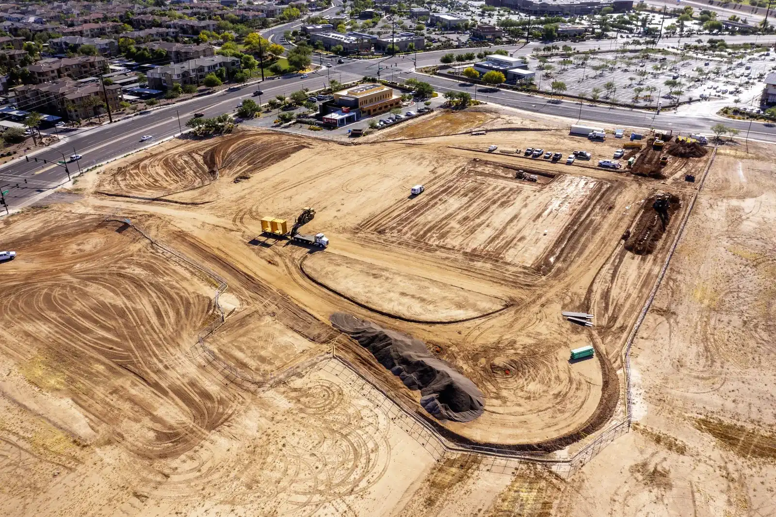
Construction projects generate an enormous amount of information. Between daily progress, material staging, site conditions, and multiple crews working at once, project managers have to make decisions and defend them later, often to an owner who hasn’t set foot on site in three weeks.
Most teams document all of that with phone photos. A superintendent walks the site, shoots twenty frames from ground level, and drops them in a folder. Those photos are better than nothing, but they fail at exactly the moment they matter: when someone asks what the north half of the site looked like on August 12th, or whether the pad was actually complete before the pour.
Aerial documentation solves that specific problem. A drone flown on a consistent schedule, from consistent altitudes and angles, produces a visual record of the entire site that anyone can read at a glance and that holds up months later.
Documenting an Arizona job site? Jack & Bean flies construction and commercial sites across the Phoenix metro, with unedited files delivered the same day. See aerial services →
What aerial site documentation gives you
A drone flight over an active site produces high-resolution stills and video of the whole footprint from above: grading, staging areas, equipment position, building envelope, access routes, and surrounding conditions, all in one frame.
That single frame does several jobs at once:
- Shows the entire site in one image instead of twenty partial ones
- Reaches vantage points no ground camera can reach
- Captures the same view repeatably, flight after flight
- Dates site conditions in a way that is hard to dispute later
The value isn’t that the photos look good (though they do); the value is that the record is complete and consistent.
Better visibility across a changing site
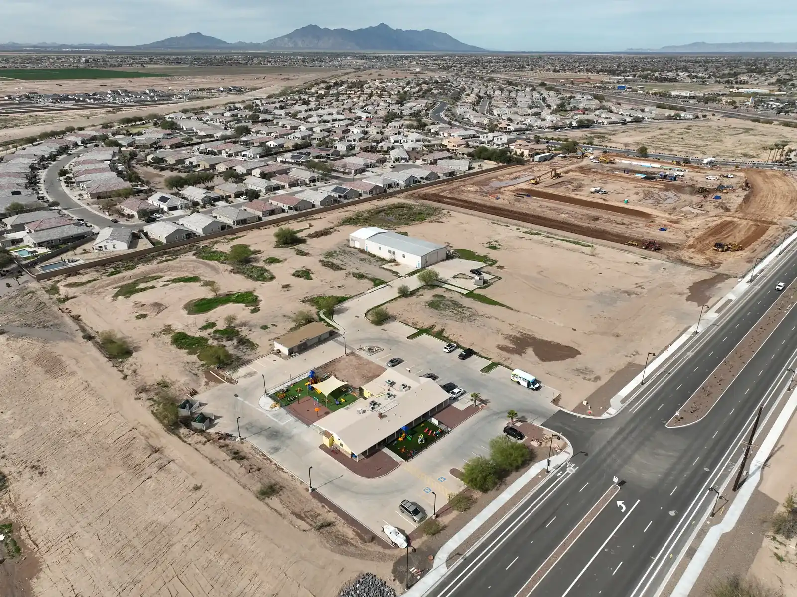
Large sites change daily. Materials arrive, equipment relocates, grading progresses, and subs work simultaneously in areas that never see each other.
An aerial pass captures a current snapshot of the whole project, which makes it far easier to brief owners, engineers, architects, and stakeholders on where things actually stand. Instead of scattered photos and handwritten notes, everyone reviews the same image.
That matters most in the conversations that tend to go sideways: a sub claiming an area wasn’t ready, or an owner questioning why a milestone slipped.
Progress monitoring across repeat flights
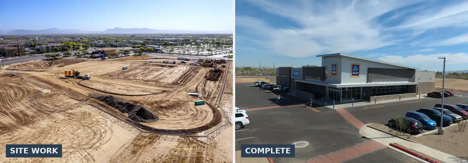
A single flight is useful. A schedule of flights is a different tool entirely.
When a site is photographed from the same positions on a set interval, the sequence itself becomes the analysis. Comparing this month’s frame to last month’s makes movement, or the absence of it, obvious without anyone writing a report about it.
Repeat flights make it easier to spot:
- Areas that haven’t moved since the last pass
- Material staging creeping into work zones
- Access and laydown problems building up over time
- Site changes nobody flagged in the field
None of this requires special software. It requires flying the same site the same way, on schedule.
Documentation that holds up in the paperwork
Aerial imagery earns its cost on the administrative side of a project.
A dated, high-resolution overhead of the site supports:
- Owner and client updates
- Pay application backup
- Contractor and sub coordination meetings
- Project closeout documentation
- Schedule verification
Every stakeholder looks at the same image, so less time goes to arguing about what the site looked like and more goes to deciding what happens next.
Put your site on a schedule. Milestone Monitor is our monthly site documentation plan: the same site, flown from the same positions, so every flight compares to the last. Ask about Milestone Monitor →
Safer documentation of hard-to-reach areas
Plenty of site documentation requires somebody to get up high: a roof, a slope, scaffolding, an elevated structure. A drone captures high-resolution imagery and video of those areas without putting a person there.
This is documentation, not certified inspection. A drone can show an owner the condition of a roof surface, capture the state of a facade, or record an elevated area that is hard to photograph from the ground. What it produces is imagery a qualified professional can review, not an engineering assessment. Be clear about that distinction before the first flight.
Where aerial photography ends and drone mapping begins
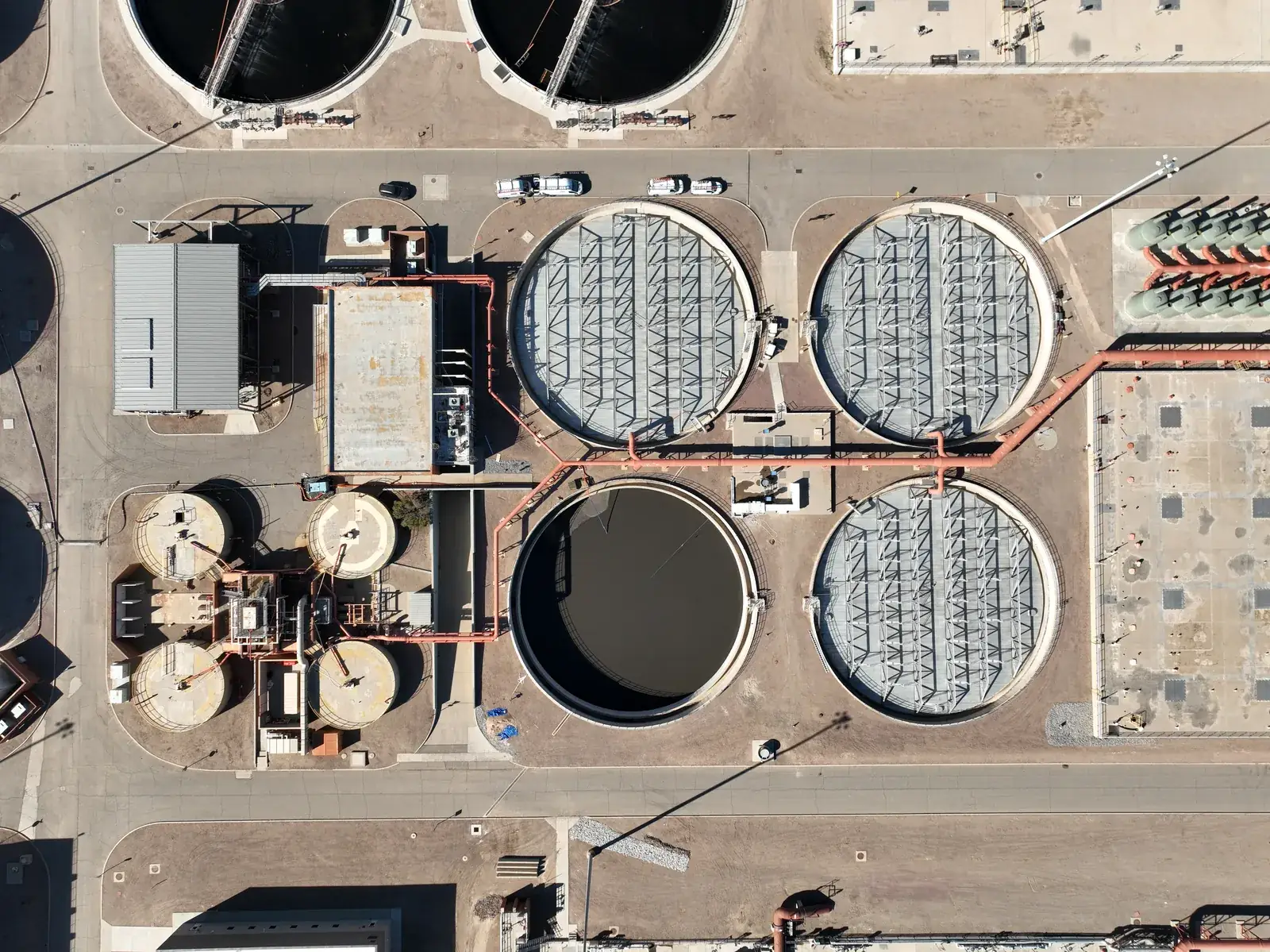
“Drone mapping” gets used loosely, and the difference is worth understanding before anyone signs a contract.
Aerial photography and video produce images and footage of a site. Drone mapping, or photogrammetry, produces measurable data: orthomosaic maps stitched from hundreds of overlapping images and corrected for distortion, topographic models, digital elevation models, and volume calculations for stockpiles and earthwork.
Those are different services, with different equipment, flight planning, processing software, and price points. A mapping deliverable a surveyor will rely on typically involves ground control points and a provider who will stand behind the accuracy.
If you need measurable, survey-grade data, hire a photogrammetry or surveying firm.
If you need a clear, consistent, high-resolution visual record of your site over time, for owners, pay apps, coordination, or marketing the finished project, that is aerial photography and video, and it costs a fraction of what mapping does.
Know which one you’re buying before you sign.
What to look for in an aerial provider
Flying a drone is the easy part. What separates a usable record from a folder of nice pictures:
- FAA Part 107 certification and insurance. Non-negotiable on any commercial site.
- Repeatable flight positions. If flight three is shot from different altitudes and angles than flight one, the comparison is worthless.
- Turnaround that matches your schedule. Imagery that arrives three weeks later doesn’t help a coordination meeting.
- Files you own. Full-resolution originals, avoiding watermarked previews on someone else’s portal.
- Airspace competence. Much of the Phoenix metro sits in controlled airspace. A provider who can’t handle a LAANC authorization will cost you a flight day.
Aerial documentation across the Phoenix metro
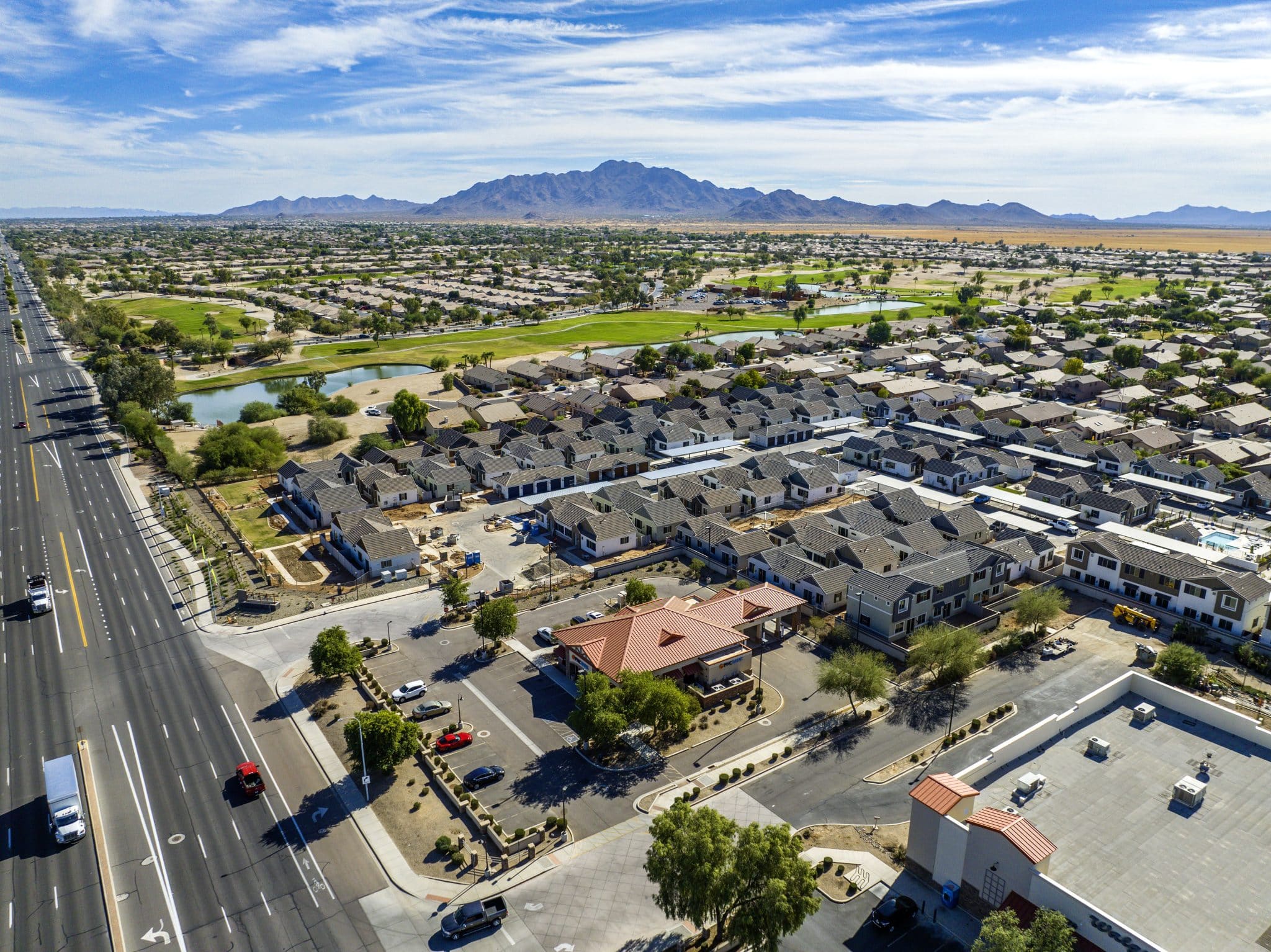
Jack & Bean is based in Chandler and flies construction, commercial, and real estate sites across the Valley, including Chandler and Gilbert, along with Scottsdale, Tempe, Queen Creek, San Tan Valley, Maricopa, and Casa Grande.
Unedited files are delivered the same day, and edited photos and video come back in one to two business days. For a project that runs for months, a recurring schedule is the version that pays off. The sequence is where the value is.
If you’re weighing equipment for in-house work, our breakdown of the best drones for construction and inspections covers the options.
Get your site on a documentation schedule
Tell us the site, the timeline, and how often you want it flown. We’ll come back with a flight plan and a quote. Request a shoot →
About the Author: Jack Dorney